
A thru-hike simulation is about finding a groove (pace) that is sustainable all day over changing terrain, and then again the next day. While Hardesty Mountain trail to Mt. June was first choice, the carbon karma was too high; for 30 minutes of total carbon cost, the Ridgeline Trail & Spencer Butte was the better choice. I left the Spring Blvd (the safest!) trailhead before 06:15 with the intent to cover at least 20 miles. Topo Trail-runners, Northface 24L day pack with ‘light summer’ gear kit, a bit of food and water to start.
Sunrise was earlier, but the sun was just topping the ridges, and from Baldy the 1x there was no mistake about unstable air. Ground cover and shorter trees were just exploding after the recent rain / sun / rain / sun.


The first time atop Spencer was nothing but clouds and fog, and I went from Spring Blvd to Spencer top without seeing another human; the birds were incredibly loud but none were singing at Raptor Center.


Ground cover wildflowers were a bit stressed due to the rain – bleached out and leaning over mostly in the morning


By 3x atop Spencer, the fog had cleared but the air still not quite summer-like.


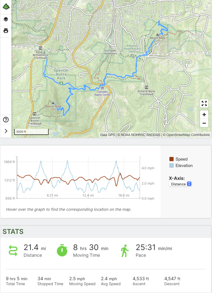
The hike itself went as planned: Spring Blvd to top, top to N. Willamette and back to top, back to Spring Blvd, and the final segment Spring to Top and back. 30 minutes of rest time for a) toe / sock gear adjustment and b) lunch. Hit the lower bar of 20 miles with decent elevation gain. As long as there is enough time between covering the same ground with this level of unstable air, the landscape and vistas are never the same – an easy way to Thru-hike sim >20 miles with a total of 30 minutes carbon karma – a true bargain!
GaiaGPS Stats
Air quality poor because of?? Walk on!
Not really air quality – just unstable air with moisture and changing seasons (May this year has been more like a typical April)