
A 4 day PCT Ramble, with 2 nights backpacking and 2 nights at Big Lake Campground (car). The original plan had a 3 day loop through the Jefferson lakes to Pamelia Lake and back to the PCT (starting at Big Lake). Once then on PCT, stop by Big Lake and then through Washington wilderness until the Belknaps. All plans need to be flexible to conditions on the ground …
- The trails around the Jefferson lakes were in terrible condition – I talked w/ 2 trail maintenance crews
- Few people were in the woods north of Hwy 20 (Santiam Pass)
- Jefferson wilderness is a giant burn – it’s exhausting mile after mile after mile
Modifying the plan put me back on the PCT earlier (at Shirley Lake Tr), and gave me 2 days in Washington, which at first blush would be confusing, but the woods have a way of changing perspectives.
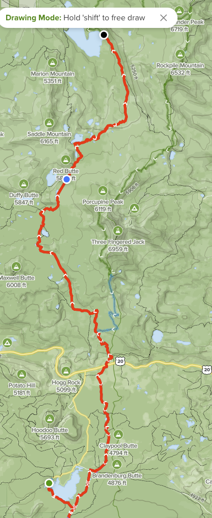
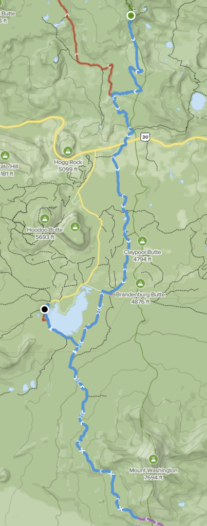
Day 1 – Patjens TH to Marion Lake
The day started out as expected with a few clouds and unstable air …


From Big Lake West to PCT requires both a user trail (not maintained) and a bit of bushwhacking on an old trail now closed – neither were ideal (nor difficult) and avoided the second time (yet both All Trails and GaiaGPS have this as valid trail). PCT junction as the sun crested the ridge and the sights turned to 3-Finger Jack.


At the next junction (Santiam Lake) is where the tide shifted and the trail became burn after burn and blowdowns unending … a smarter person would have added up the W/NW slopes destroyed last year I’ve walked thru and avoided this. Yet, even within absolute destruction (burns), life is exploding and can be surprising


Not only surprising, but green!


The night at Marion Lake was quiet with 2 forest service crews and 2 other parties scattered around the creek side of the lake.
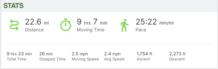
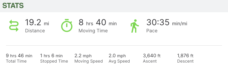
GaiaGPS Stats for Day 1
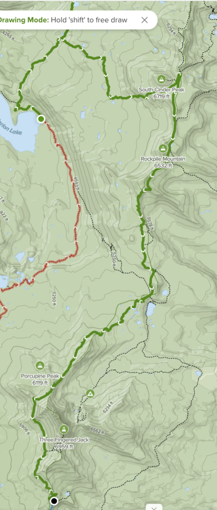
Day 2 – Marion Lake to PCT mile 2005.2 (Guthook campsite)
Morning at Marion Lk was spectacular, and who would have known that this would be the hardest day of them?


Not far from the lake, the ever present burn scars just extend beyond one’s imagination. At Lake of the Woods (or toothpicks), the trail vanished – I wasted about 30 minutes dancing with GPS trying to find the trail. At that point, with few other hikers, I turned around and headed back toward PCT and 3-Finger Jack … (both All Trails and GaiaGPS had this as viable trail)


Passing South Cinder Peak on the way, there were old cairns on one small portion of the trail


During this section, the wind was howling with these wild noises coming from the trees – I’d heard before, but couldn’t identify the source. This time, an idea …


Before hitting campsite, 3-Finger Jack’s shoulder had to be climbed … and I saw my first Oregon goats (pic is terrible!). On this stretch of PCT, 3 other hikers were going north (most bugged out at Santiam Pass to avoid the closed section)


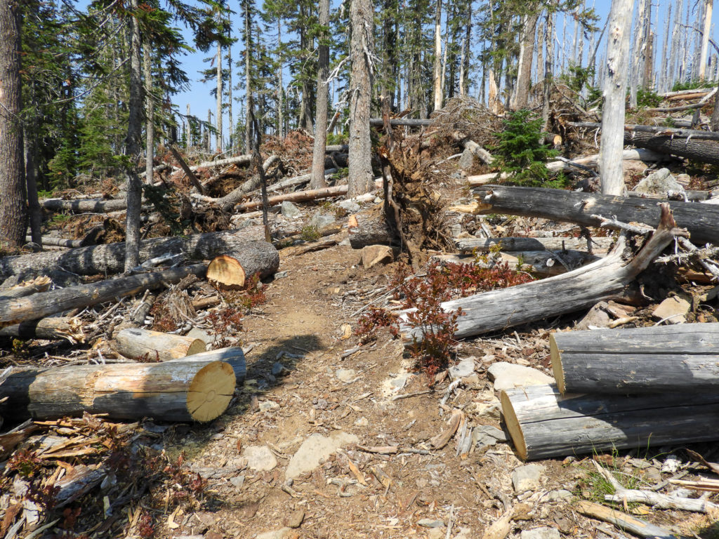
In case you think i was kidding about the blowdowns …
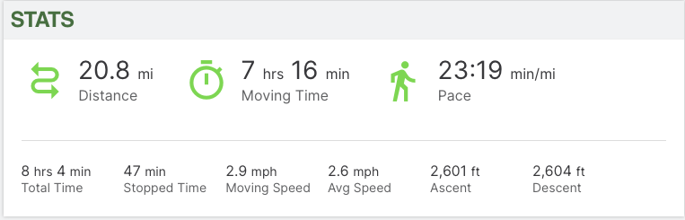
GaiaGPS Stats for day 2
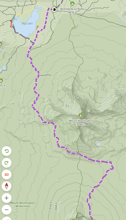
Day 3 – PCT mile 2005.2 to Big Lake
Starting the day at first light it was thru more burns and was at Santiam Pass early and met 2 folks heading up to climb 3-Finger Jack (ropes and all!). – right south of the pass is PCT mile 2000. There were two small shrines.


Now SOBO on PCT, I cruised by the cut-off to Big Lake (Monday’s entry) and continued on facing Mt Washington and my expectations of unending lava flows. Surprise! It wasn’t all that I thought, and I truly fell in love with this northern section of Washington Wilderness.


NOBO PCT traffic was thin as most hikers were in WA and others were at the PCT Trail Days in Cascade Locks. Several times this season a Wood Grouse has scared the juices out of me (they hide and then take off loudly as you near them), and finally one sat still long enough for a portrait.

Walked in late to Big Lake West campground without reservation, but there were openings. It’s a weird, really weird campground under Washington; a big lake, far enough from pass so no traffic noise, but … boats, OHVs, – luck for me, many people didn’t show up due to fires, closures and weather.


That evening, the winds of weather changed … clouds, cool winds and the smell of rain. I prepped for rain, and it rained enough to dampen the dust and make mud. ….. but was it ever nice to have rain – first time all season.
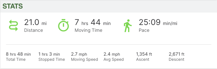
GaiaGPS Stats Day 3
Day 4 – Big Lake TH Out / Back SOBO PCT
Since I cut off that day 1 section to Pamelia Lake, I had a free day. The night before, I searched for a nearby trail of interest, but decided that the SOBO PCT back thru Washington Wilderness as far as the lava beds was the ticket … BUT, to avoid that user trail and closed trail, I drove the 5 minutes to Big Lake PCT TH (permitless for that TH, but one for Patjens)
An early morning with cool crisp air (unstable) and the first person on the trail after the rain gave me chance to learn all the animals (foot prints) that were hunting / traveling with me. The predators are smallish but very active – never saw one.


It wasn’t long before PCT trailside campers started popping out of the woods, and in one case, a couple used a recent fire area and staging area (this season)to camp. With the fog and clouds, it looks like they were sitting on the edge. As I walked by the man asked the woman if she had eaten all her breakfast and how good was it … real life goes on.

Here’s a view of lava beds

A quick PCT cruise to my turn around point, and back to Big Lake TH and to campground. As both campgrounds were <30% full, I negotiated with the camp host to stay at Big Lake (not west) campground. Had a great spot and watched osprey hunt as the sun set


As the sun set further, Washington put on quite a show


GaiaGPS Stats Day 4
Day 5 – A leisurely morning on Big Lake and a drive home
Another surprise as I drove on Hwy 20 to avoid Mckenzie River area (i could not see the burn again), the fog / clouds were thick enough that water / wipers on my car. 2 days with water in the middle of fire season … ah!


Summary / Recommendation:
Washington Wilderness was WAY surprising and beautiful. I will go back. Jefferson Wilderness is an odd bird and the southern section (3-Finger Jack area) will most likely be avoided in future even though there are beautiful spots. Big Lake is not a hiker’s camping area, but can work out.
Guides were a complete failure. Both All Trails and GaiaGPS had 2 mistakes in this hike that were costly for me in terms of energy burnt and time / risk spent. Both will require greater diligence in planning phases. On the other hand, Guthook reviews of water and campsites were spot-on for this area.
Gear Update:
My Topo Terra* shoes wore out on Day 3; ~300 miles and they are complete toast. My Granite Gear Crown2 pack failed miserably as I could never get a ‘un-noticed fit’. I ran into a REI employee on PCT with same pack and she loved hers; we decided that packs and body shapes are not all the same. REI Flash Air tent worked out ok in the rain; the bathtub worked great, but the upper sections were easily moistened with condensation.
Michael, Has all of what you seen, changed any of your thoughts, goals, etc.? Can’t imagine you are the same person as before all of this. Love, Mom