
Another last minute plan change to a closer-in hike to limit the carbon price of the adventure. Ridgeline Trail is part of the Spencer Butte trail system or the inverse, and is heavily used at different times within 1 mile of every trailhead.
This was the last local gear test for the next phase of higher elevation hikes and everything worked out. The Ridgeline / Spencer trail system is a terrific low-carbon-cost place to hike and one can get a 10-15 mile & >3,000 elevation gain hike with a bit of creativity.
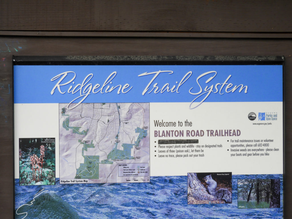
The hike started before 07:00 at the N. Willamette trailhead (TH) and went west toward Blanton TH. This section of the trail is a ‘seam’ between forest and houses along that seam; very similar to the Wildwood Trail in Forest Park, PDX.
This first section (N Willamette to Blanton) was very quiet until this character started singing … i stood there for a couple of cycles thru the song. Wonderful.


That was recorded on iPhone SE voice memo – nothing more. If this guy did not win a sweetheart with that song and perch, then the world is just upside down.
After this, a few great people stopped by to chat even a couple who hike often and section completing the PCT – fellow spirits. The turkeys started showing up too. They use the trail as their highway and every yard has an entrance / exit ramp.
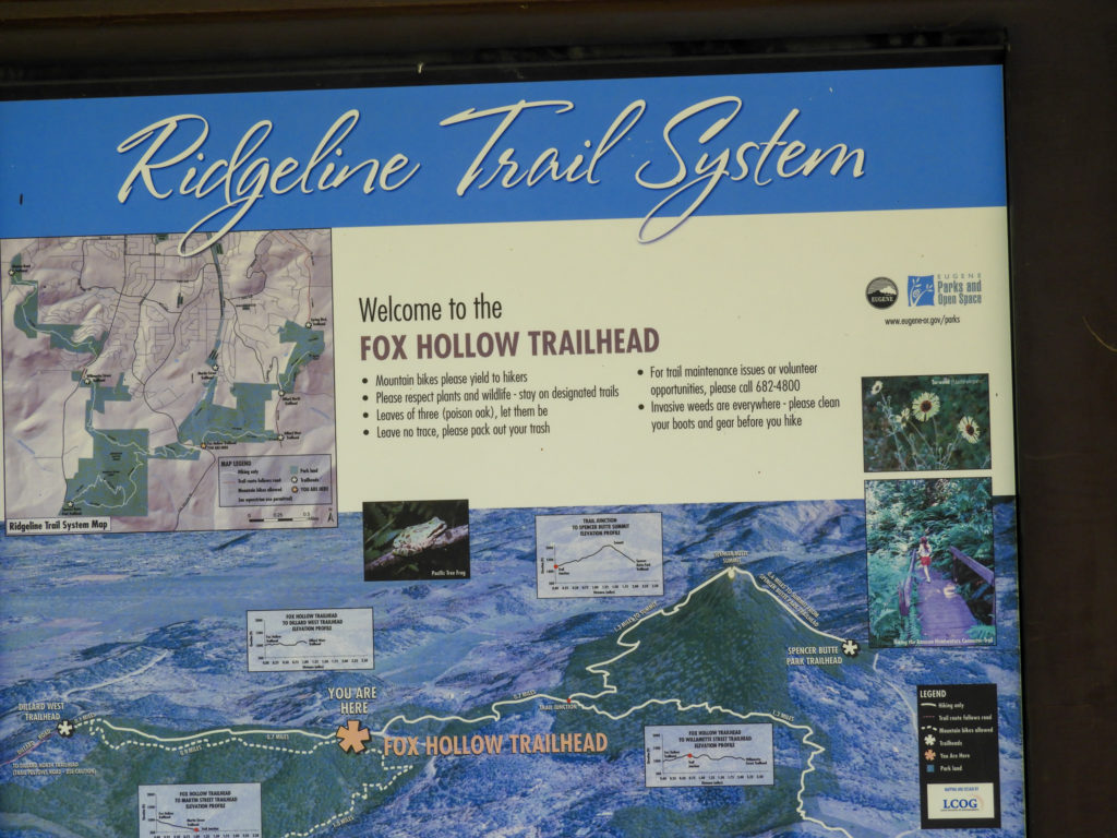
The second section (N Willamette TH up/dn Spencer Butte to Fox Hollow) was incredibly green at lower elevations and a wildly unstable sky above.
Below / low


The sky from the top was odd both times


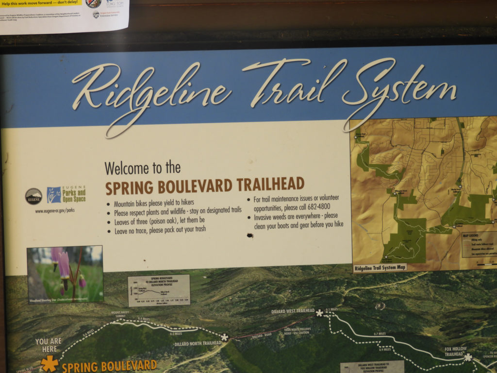
The Fox Hollow to Spring Blvd section crosses over Baldy and then thru another neighborhood seam.


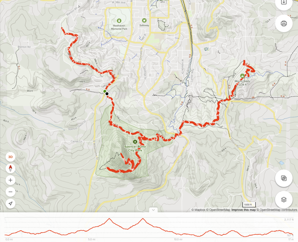
Summary: Probably the last ‘training’ hike on Ridgeline / Spencer of this season. The area has been very kind to me over this spring training season. Being able to have this quality of hiking closer than 15 min drive is a gift. If you live in Eugene and you’ve not done this, why not? If you visit Eugene, you have something to add to the list.
All Trails Factoids
Distance: 16.6 miles | Elevation Gain: 3,655 ft | Avg Pace 24:12 / miles — Recording
| Gear Type | For this Hike |
| Pack | Gregory Citro 30 New Pack: A gear review will be published after 2x time |
| Shoes | Topo Trail runners |
| Top Layers | Baselayer LS |
| Bottom Layer | REI Sahara convertible pants |
| Socks | Dual layer REI Silk liner + REI lightweight Merino wool |
| Gaiter | REI ‘On the Trail Gaiters’ |
| Water | Bladder 2 L – finished (no other water carried) |
| Supporting tools | No Trekking pole – not needed No toe callous bumpers – emergency only |
You are gearing up for what???? And to make tomorrow really special you will…………………….